Samaria Gorge
Samaria gorge is a National Park in Crete and is considered one of the longest gorges in Europe, with length of 16 km. Being one of the most famous hiking routes on the island, it attracts hundreds of visitors daily. The park is open from May to October, as dates may slightly vary depending on weather conditions. On rainy days the gorge is closed due to risk of falling rocks. There is an entrance fee of EUR 5 per person.
The entrance of Samaria Gorge is at the Omalos plateau in Lefka Ori Mountain, in an area called Xyloskalo, and exits close to the south coast. There are daily bus services from Chania Town to Xyloskalo, departing early in the morning. Organized bus tours with a guide are also available. With or without company, you will always meet other hikers on the route. The total length of the national park is 13 km but there are extra 3 km in order to reach the seaside village of Agia Roumeli, so the route is considered 16 km long. You can leave Agia Roumeli only by ferryboat or on foot, there is no road for cars. Usually the hiking is done in the following way:
- You enter the gorge from the north (Xyloskalo)
- You reach the south coast with the village of Agia Roumeli where you can have a rest/swim or even sleep in any of the hotels
- You take the ferry from Agia Roumeli to Chora Sfakion
- You take the bus from Chora Sfakion to Chania Town or elsewhere on the island (the bus schedule is synchronized with the last boat arriving from Agia Roumeli)
Those who cannot walk the entire route may go by ferry to Agia Roumeli, enter Samaria from the exit, see part of the gorge and get back to the village. However one should keep in kind that climbing up to the entrance of the national park is steep, too.
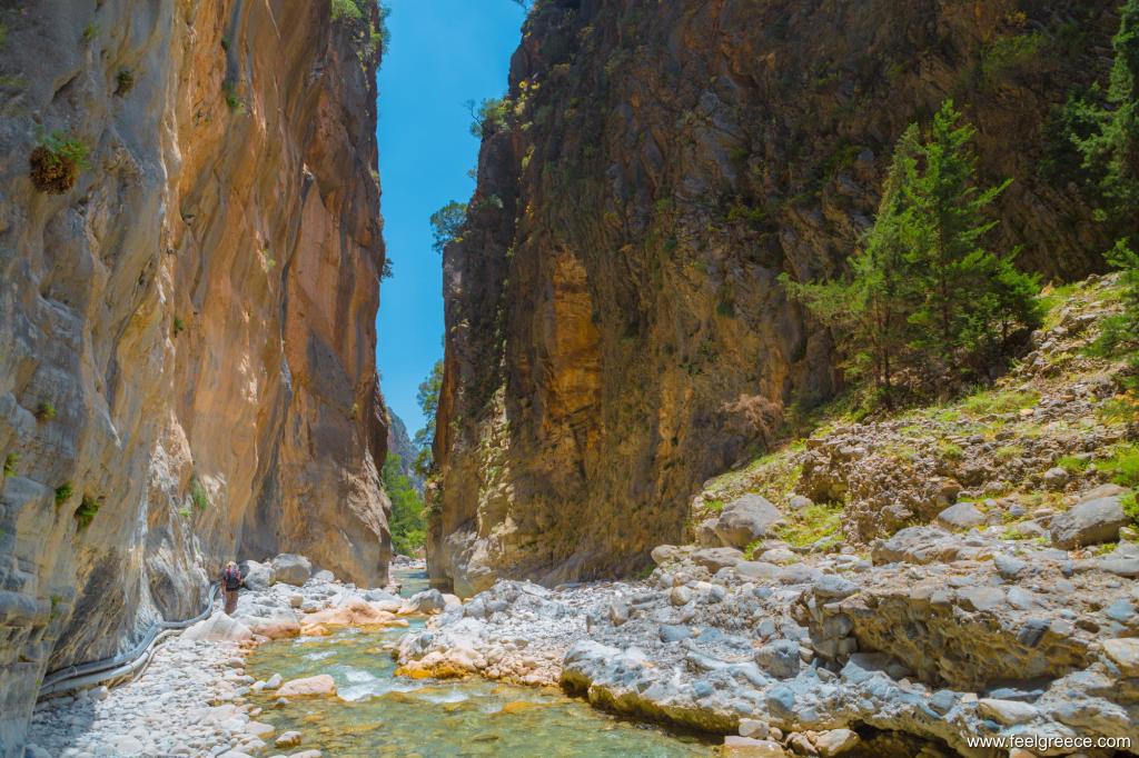
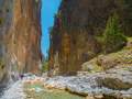
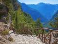
The route of Samaria is considered of average difficulty and not suitable for small kids. The hiking takes approximately 5-7 hours in one direction, depending on your pace and break time. Within the gorge there are drinking water sources in many places, toilets and rubbish bins, but no food or snack. You should bring your own food, sun protection and comfortable shoes. The first two kilometers after the entrance slope straight down on uneven path. After that the route is not so steep but the path is covered by stones (so flip-flops would be a very bad idea) and you need to cross a small river through primitive wooden bridges or planks. The high and almost vertical cliffs on both side of the gorge rise up to a height of 150 to 500 meters, and at the narrowest part of the passage near the exit, called the Iron Gates, the width is less than 3 meters.
Once the village of Samaria existed in the middle of the gorge but it is now abandoned and you can see only ruins of buildings and old small churches on your way. The endangered Cretan kri-kri goats living in the park can sometimes be spotted around the river, although they are shy and try to avoid people.
Photos
Address and contacts
highlights: national park and hiking route, nature in Chania Region, Crete, Greece